The bottom line with a run, for some of us at least, is that no matter how long it is or how undulating it is, it should be actually runable. For others that statement is the last hiding place of wimps.
The solution for the organisers of the 15/26 miler, through the mud of The Vale Belvoir* Leicestershire, is to sidestep the whole argument by calling it a 'challenge'. Then the fact that it is almost impossible to run through over half of the course becomes immaterial.
The Belvoir Challenge, which has been going for 30 years, is organised by the PTA of Harby School to raise funds. It is mostly off road using footpaths, tacks and open fields, often open ploughed fields, ploughed fields covered in thick, rich alluvial deposits making the mud particularly muddy. This is a unique and challenging course. And that is one of the things that it is famous for. The off-road, claggy, muddiness of it all.
However, especially amongst running wimps, it is also famous for two other things. Firstly for being one of the local events to avoid at all costs. But secondly for the cakes.
PTAs have a long tradition of fundraising. This does not usually involve organising off-road opportunities for members of the general public to have a go at putting themselves into the waiting room of the local A&E, the nearest of which is a long and bumpy ambulance drive away through the narrow winding roads of South Nottinghamshire. The normal method involves baking cakes to sell at poorly attended summer fates. Clearly, this tradition existed at Harby School long before they hit on the idea of torturing unsuspecting fun runners, because the cakes have not only remained a part of the fundraising efforts of the PTA, they have become the reason most people enter the event in the first place. There are probably some who only enter for the cakes and consider the entrance fee well worth it for the opportunity to break the diet with an open-ended, eat all you can, homemade cakefest. The only drawback is the fact that the cakes are to be found out on the course at two feeding stations. One about halfway round in a field and the other in a village hall at Eaton at the 10 mile mark. Clearly, the intention is to discourage the casual cake muncher from filling his/her boots without either breaking a sweat or getting their trail shoes dirty. The only acceptable route to the cakes, which have gained an almost mythical reputation for quality, is to run the course.
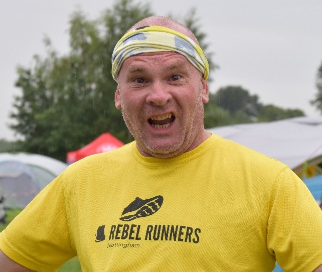
Well, they reckoned without this cunning running wimp who as a conscientious objector on this run, offered to do the driving and take the photos for Rebel Runners. It would mean nipping around the course to some carefully selected fixed points, that would allow vehicular access and offer a good vista of the pitiful competitors pitting themselves against the elements and of course the course itself. It is a mere coincidence that the only points that offer this combination of factors, just happen to put me within grabbing distance of every delicious sugar filled calorie available.
I leave the house at 7 to pick up the various poor souls whose lot it is to do all the heroics. Offer them my condolences and reassure them that whatever happens their names will be remembered in the Rebel Runner Roll of Honour for generations to come.
Drop everyone off at the start for 8:30 ish. Take some photos. Find a bacon cob to prepare the stomach for what is to come. Then head off to the water station at 3 miles for some more photos and a rendezvous with anyone known left standing. Before hightailing it to the delights of Cake Station No. 1.
Now I am fairly good at reading an OS map. Reading an OS map while driving I am not so good at. The general quick glance then a lot of guessing, is the technique I have developed although not perfected, over the years. I know I have to turn left, so I turn left. Sort of randomly.
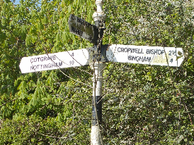
It is a long straight track. Just like so many other long straight tracks when you turn left anywhere in the Vale of Belvoir.
In the distance there are marshals and there are Belvoir Challenge competitors coming out from a muddy field and onto the track. But very much the back markers caked in heavy claggy mud. Already their faces have developed that 'What am I doing here' look that permeates most First World War photos. I have clearly managed to successfully find the end of the first field.
Time to take a good long look at the map and fix all the important features in my head to save me looking at it again. A sensible idea.
Then back to the road passed the turn-off to Stathan, which the race passes through. I know that because I put a cross on the map at Stathan. Follow the road to the left turn off to Plungar then follow the road through to Granby. Sorted. Map casually tossed on the back seat.
Park the car and get out the camera.
The runners are coming up the hill from the water station looking like a retreating army dragging its collective feet to the distant sound of their vanquishers dancing and jigging to the 1812 Overture. There are smiles on the their faces. But they are fixed botox smiles that tell the story so far. They are 3 miles into 15 or 26 miles of purgatory. Only the thought of the first cake stop, another 3 miles of mud away, is keeping them going.
I take some snaps then head off to fill my cake hole before this lots have a chance to devour the bleeding lot!
Now the two most important things in navigation are knowing where you are and knowing where you are going. The best map and the finest map reading in the world will not help you if you can't sort either of those basic things out. Perhaps the best way to get it all wrong is to allow your mind to make assumptions without referring back to your notes. That way, when your mind is telling you that the first feeding station is at Stathan, because ... well last time you glanced at the map you noticed that you had put a cross on, it must be right, right?


 The Belvoir Challenge will take place on the 1st March 2025. The event starts at 09:00am.
 Guy did the Belvoir Challenge back in 2022.
He ran it with an audio recorder … and here is the result.
Why not 'run' with him and experience the event from the comfort of your armchair?
Guy did the Belvoir Challenge back in 2022.
He ran it with an audio recorder … and here is the result.
Why not 'run' with him and experience the event from the comfort of your armchair?